New River Inlet - Hurricane Florence - Before/After

180912142520-hurricane-florence-satellite-222-p-m-et-9-12-18-super-tease.jpg

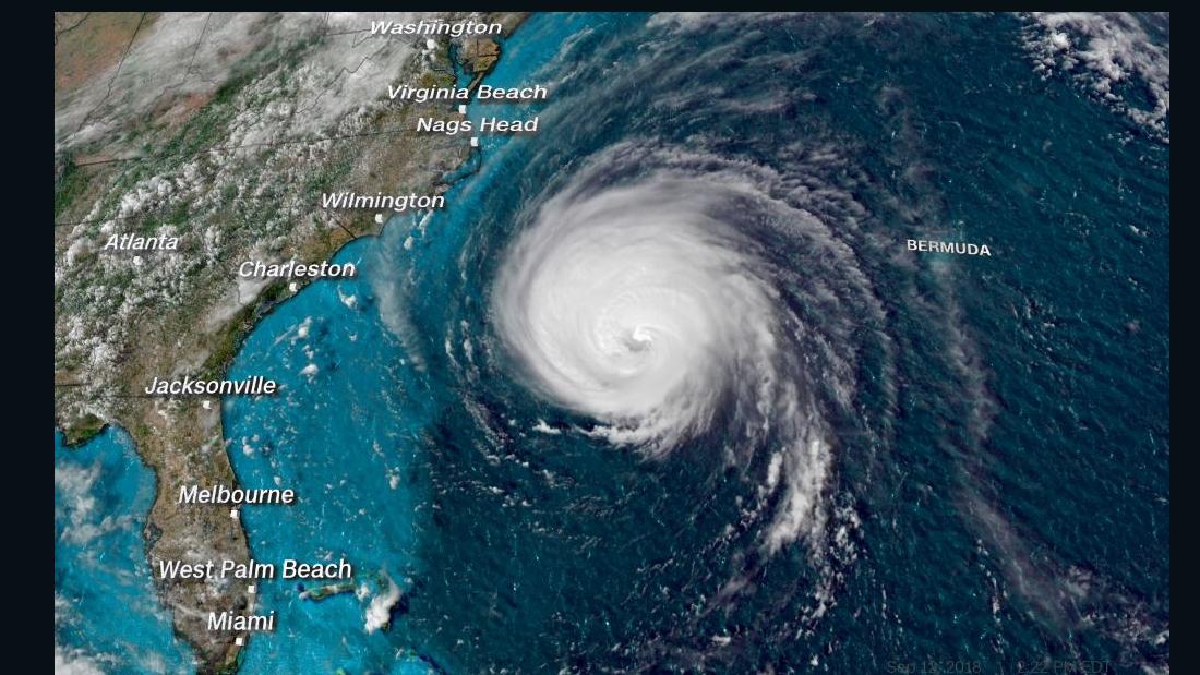
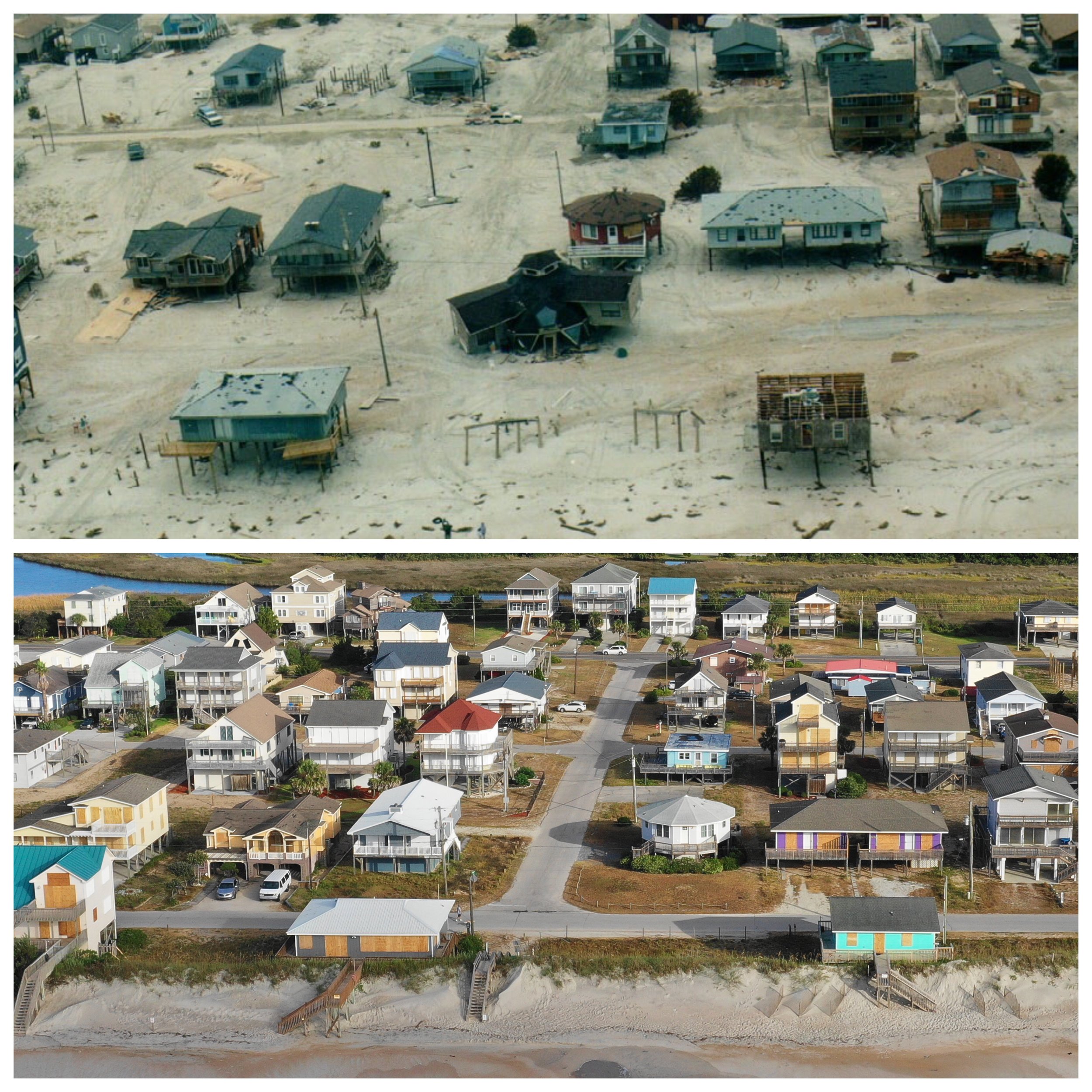
Hurricane Florence was said to be “The Storm of a Lifetime”. With that being said it had a major impact on the South East Coast of North Carolina. Just before the storm came a shore we went out to several different locations on Topsail Island including New River Inlet and documented what the beach looked like before the storm Sept. 12th, 2018. On Sept 26t, 2018 we were granted access to North Topsail Beach to access the damage caused by the storm. New River Inlet is vital for many local fisherman as well as the Military aboard Camp LeJune. They use this inlet on a daily basis. In previous years the inlet has been very difficult to navigate as it has not been dredged in years. It appears from these aerial shots it seems the hurricane had a little effect on the inlet. If anything it looks like the storm washed some of the sand out of the inlet and made it deeper. On the day we shot the before shots the ocean had a fairly small swell running about 2ft at 14 sec. On the day we shot the after shots there was a much larger swell that was about 5ft at 13 sec. We noticed that the outer sandbar on the Inlet was not breaking so the water depth could be deeper than before the storm but the only way to tell for sure is to go out and check it with a boat.

Before Storm 9.12.18

After Storm 9.26.18

Hurricane Florence Disaster Recovery 3D Tours - PROFESSIONAL REAL ESTATE PHOTOGRAPHY / 3D MATTERPORT VIRTUAL TOUR / AERIAL PHOTOGRAPHY


In the wake of Hurricane Florence we will be working closely with Insurance Companies and Homeowners to help document any and all damages that occurred during Hurricane Florence’s destructive path through North Carolina. Our 3D Matterport Virtual Tours can specifically point out every detail in high definition, measurements can be taken from the virtual tour, floor plans can be rendered and notes about certain items can be added. To learn more about how we can help your disaster recovery efforts please visit www.uniquemediadesign.com for more info!

New Topsail Inlet Before Hurricane Florence - Aerial Virtual Tour

This morning we shot all over Topsail Island, NC documenting what the island looks like before Hurricane Florence from the air. This is one of our favorite aerial virtual tours that we shot today. Over the past 15 years Topsail Island has grown substantially and most people don’t realize the destruction that Hurricanes can do to an island. We plan on going back to all the locations that we shot this morning in the wake of the storm to give perspective of what the damage is. We shoot thousands of properties each year on Topsail and this new technology in 3D virtual tours is going to help enhance it!

Below is an image that we took this morning to show a good before and after. The (Top) image was taken after Hurricane Fran in Sept 1996 and the (Bottom) we shot this morning as people were just finishing boarding up. Take notice to the circular house in the middle as a point of reference. This house and a few around it are still there today. Hurricane Fran was a Cat 3 Hurricane with a 12ft storm surge. Hurricane Florence is a Cat 3 right now with an expected 12ft+++ storm surge! It will be interesting to see how this little piece of paradise that we love handles this storm.

Hurricane Fran (1996)/Hurricane Florence - 1300 North Shore Dr, Surf City, NC

Hurricane Fran (1996)/Hurricane Florence - 1300 North Shore Dr, Surf City, NC


Aerial Virtual Tours - Queens Grant -Topsail Beach, NC

The next wave in new drone technology is here and it is taking virtual reality to the next level! UMD is in the final Beta testing of its new product - aerial virtual tours. This new imaging gives online viewers a entirely new perspective on properties and their layout.