
New Topsail Inlet Before Hurricane Florence - Aerial Virtual Tour
/This morning we shot all over Topsail Island, NC documenting what the island looks like before Hurricane Florence from the air. This is one of our favorite aerial virtual tours that we shot today. Over the past 15 years Topsail Island has grown substantially and most people don’t realize the destruction that Hurricanes can do to an island. We plan on going back to all the locations that we shot this morning in the wake of the storm to give perspective of what the damage is. We shoot thousands of properties each year on Topsail and this new technology in 3D virtual tours is going to help enhance it!
Below is an image that we took this morning to show a good before and after. The (Top) image was taken after Hurricane Fran in Sept 1996 and the (Bottom) we shot this morning as people were just finishing boarding up. Take notice to the circular house in the middle as a point of reference. This house and a few around it are still there today. Hurricane Fran was a Cat 3 Hurricane with a 12ft storm surge. Hurricane Florence is a Cat 3 right now with an expected 12ft+++ storm surge! It will be interesting to see how this little piece of paradise that we love handles this storm.
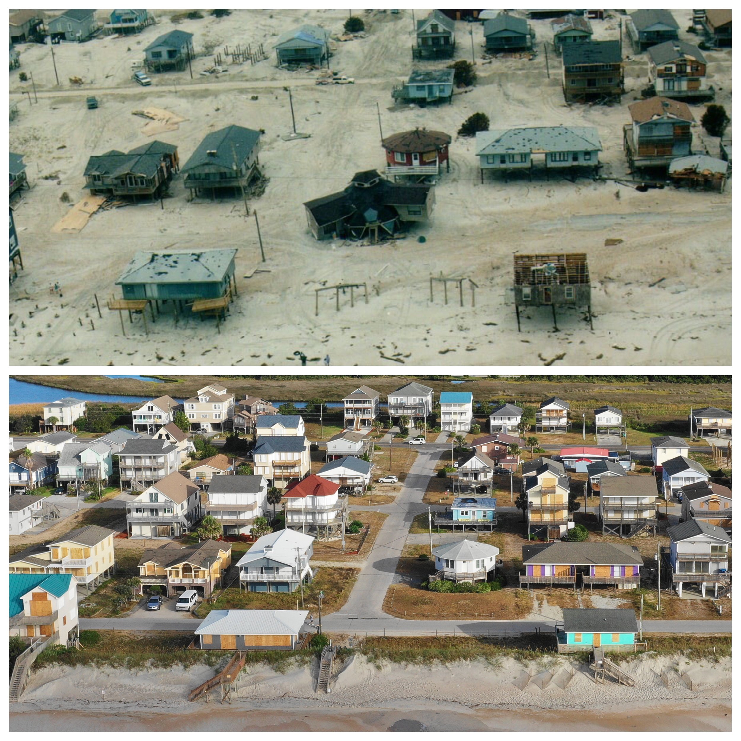
Hurricane Fran (1996)/Hurricane Florence - 1300 North Shore Dr, Surf City, NC